

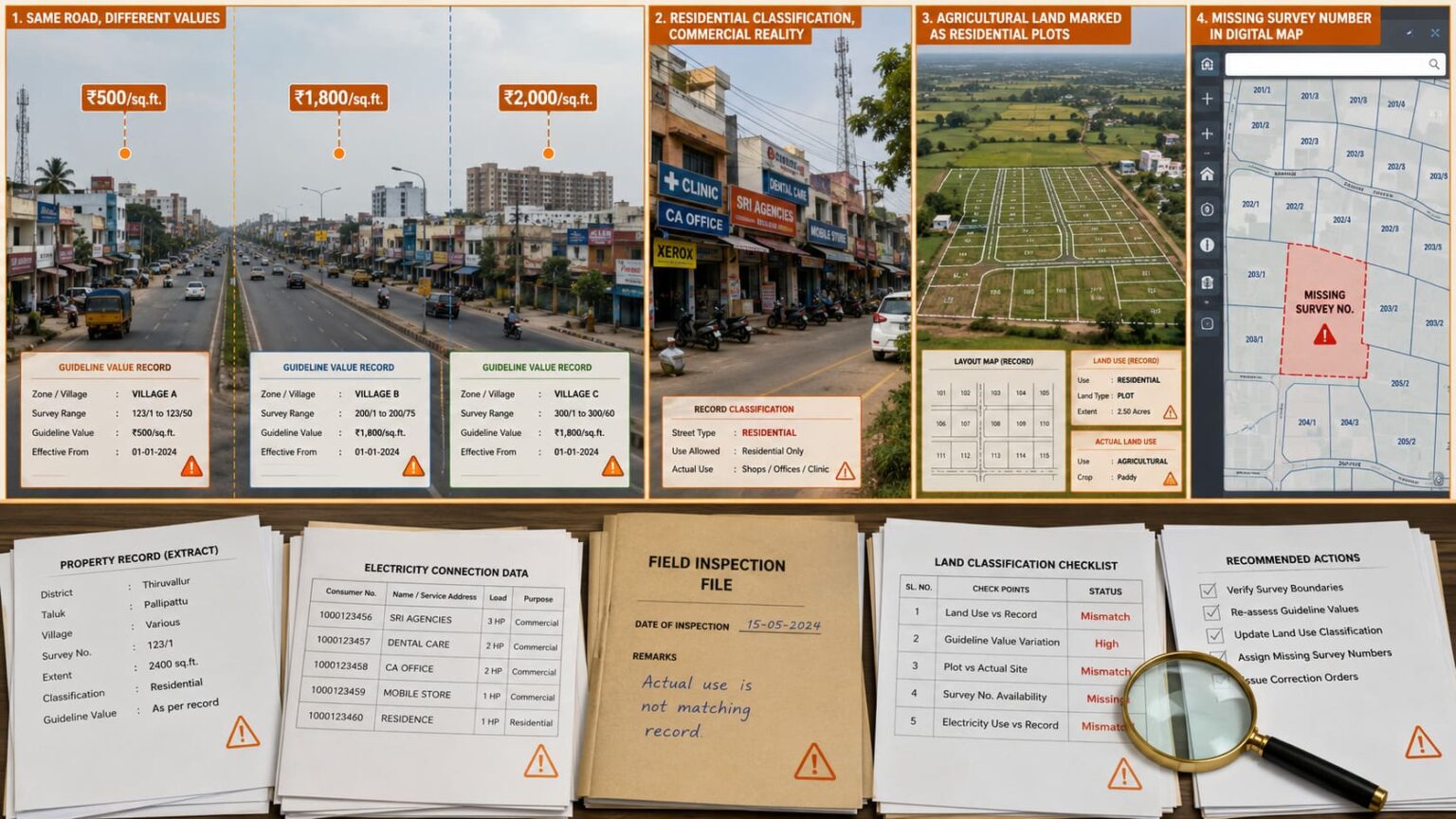
Tamil Nadu’s Registration Department is planning a big update of guideline property values across roads, villages, and fast-growing urban areas.
The goal is to match official property rates with current market prices, real land use, and ongoing development.
The move follows a valuation committee meeting held on July 15, where several problems in the existing guideline-value register were accepted by the Inspector General of Registration.
District-level valuation sub-committees have now been allowed to begin corrective action under the Tamil Nadu Stamp Rules, 2010.
Why Guideline Values Are Being Updated
Guideline value is the minimum rate used to calculate stamp duty and registration fees during property transactions.
In many places, these values have not changed even though development has increased quickly. Because of this, some areas are shown as undervalued on paper, while other nearby roads with similar features show different prices.
The department has found three main problems:
- Old values in fast-developing areas
- Uneven pricing between similar locations
- Mistakes in land classification and records
The State had earlier announced that guideline values would be assigned to every land survey number in Tamil Nadu. The aim is to reduce valuation gaps and ensure that each property has a clear value instead of depending only on broad village, locality or street-based rates. This survey-number-wise approach can also help correct missing records and improve consistency during registration.
Learn more about this in: https://community.verified.realestate/article/survey-number-wise-guideline-value-in-tamil-nadu-to-be-assigned-by-june-end/
Electricity Connections Will Help Classify Streets
A key part of the update is using electricity connection patterns to decide how streets are classified.
The Registration Department will check the percentage of commercial electricity connections on each street:
- 60% and above commercial connections → Treated as commercial streets
- 25% to 60% commercial connections → Treated as mixed-use streets
- Below 25% commercial connections → Treated as residential streets
This method is expected to show how streets have actually changed over time.
For example, a road that now has many shops, offices, clinics, and restaurants—but is still marked as residential—may be changed to commercial or mixed-use based on its electricity usage pattern.
Fixing Uneven Values in Similar Areas
Officials have also noticed that roads with similar features—such as width, road access, traffic, and business activity—often have very different guideline values.
In some cases, even nearby stretches of the same highway may have different values only because they fall under different village limits. These differences will be reviewed.
The review will check whether these differences are correct. If they are not justified, the values may be adjusted so that similar areas have more balanced pricing.
Suburban Growth Leading to Reassessment
Fast growth in suburban areas around Chennai and other cities has also led to this review.
New housing projects, commercial buildings, better infrastructure, and higher demand have increased real estate prices in many areas, while guideline values have stayed low.
Places like Navalur, Vengaivasal, Perumbakkam, and Medavakkam nearby Sholinganallur are examples where development has grown much faster than official valuation updates.
Correction of Land Records and Errors
The process will also correct mistakes in land records.
Some agricultural lands may have been wrongly recorded as residential plots. These will be checked using AgriStack data and corrected if needed.
Also, missing survey numbers along highways and district roads may be added to the official guideline database to improve accuracy.
The New values will be assigned based on proximity to hubs like industrial areas, commercial centers, and transport hubs
Coverage in 1,020 Villages and Panchayats
The update will cover 1,020 villages and panchayats located near growing urban areas.
To decide new values, officials will look at:
- Recent registered property sales
- Property advertisements and listings
- Field inspections
- Land acquisition compensation data
- Bank auction and sale records
District collectors and valuation sub-committees will review all findings before final approval of new rates.
Impact on Buyers and Property Owners
If guideline values increase in some areas, property registration costs and stamp duty may also increase for future transactions.
At the same time, matching official values with real market prices may reduce large differences between registered rates and actual market rates.
If land is wrongly classified, corrections may lead to new valuations, which could be lower or higher depending on the change.
The final impact will depend on the location, level of development, road type, and committee decisions.
To get the latest updates on guideline value corrections, please contact the Verified Real Estate team.
Challenges in Implementation
Even though the plan is welcomed by industry groups, there may be challenges in implementation.
Due to the staff shortages in the Registration Department there may be a slow down in field inspections and data updates.
The Builders Association of India has also suggested that guideline values should be updated more often so that large gaps do not build up over time.
Overall, the aim of this exercise is to create a more accurate, clear, and consistent property valuation system by updating old records, fixing classification errors, and using electricity connection data to better reflect real land use.