

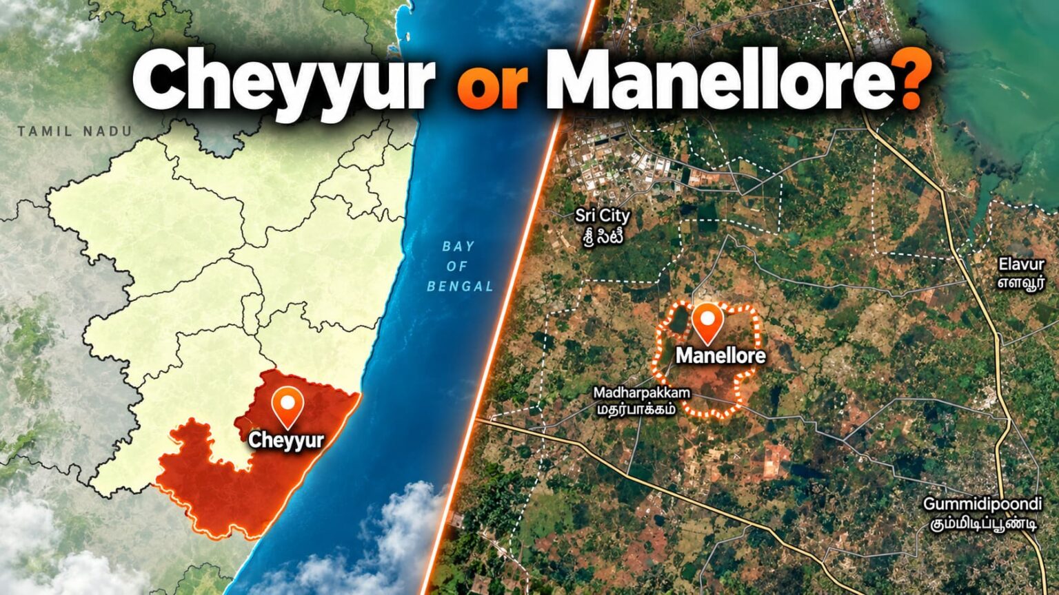
After dropping the Parandur airport proposal, the Tamil Nadu government has reportedly shortlisted Cheyyur in Chengalpattu district and Manellore near Gummidipoondi in Tiruvallur district for Chennai’s second airport.
Tamil Nadu Industrial Development Corporation Limited (TIDCO) officials have reportedly completed preliminary inspections. The Airports Authority of India (AAI) is expected to conduct detailed feasibility studies before the government selects a final location.
Why Were Cheyyur and Manellore Shortlisted?
Cheyyur is situated near to southern Chennai, Chengalpattu and Puducherry-side areas, while Manellore is situated near to North Chennai, Tiruvallur and the adjoining Andhra Pradesh industrial belt.
Both locations are also believed to have the potential to provide the large and continuous land required for an airport while reducing the agricultural, environmental and residential impact seen at Parandur. However, the government has not released a comparative study proving these advantages. Their actual suitability will be known only after AAI completes its technical feasibility study.
What are the concerns at Manellore?
Manellore is around 50–60 km from Chennai and approximately 35 km by air from the Sriharikota space centre. AAI must examine whether rocket-launching operations could affect the proposed airport’s air routes.
The study must also check nearby waterbodies, migratory-bird movements, reserve forests and possible CRZ restrictions. Airport-related building-height restrictions could eventually extend several kilometres beyond the runway boundary.
What are the concerns at Cheyyur?
Cheyyur is approximately 100–120 km from the existing Chennai airport, around 40 km from Puducherry airport and about 35 km from Kalpakkam.
Reports indicate that the area may require defence clearance because its airspace is influenced by the Tambaram Air Force Station. Kalpakkam’s prohibited airspace, coastal zones, wetlands and agricultural lands must also be studied.
What Will AAI Check Before Approving an Airport Site?
For a new airport, AAI and Directorate General of Civil Aviation (DGCA) will examine much more than the land inside the proposed boundary. The surrounding region is checked to determine whether aircraft can safely approach, land and depart.
| Check | What will be examined | Why it matters |
|---|---|---|
| Airspace | Nearby civil airports, defence airspace, rocket-launch zones and existing flight routes | Conflicting airspace may make aircraft operations difficult or unsafe |
| Runway alignment | Wind direction, crosswinds, rainfall, fog, cyclones and visibility | Determines the safest direction and position of the runway |
| Obstacles | Buildings, towers, chimneys, power lines, wind turbines, hills, trees and cranes | Objects penetrating the airport’s safety surfaces may need height restrictions |
| Bird hazards | Bird sanctuaries, migration routes, wetlands, lakes, fish farms, garbage dumps and slaughterhouses | Large bird movements can increase the risk of bird strikes |
| Terrain | Ground elevation, slopes, hills, soil stability and uneven land | The site must safely support runways and airport buildings |
| Waterbodies and flooding | Lakes, tanks, rivers, canals, wetlands, drainage channels and historical flooding | Waterlogging and flooding can affect runway safety and airport operations |
| Environmental restrictions | CRZ areas, reserve forests, mangroves, protected wetlands, wildlife sanctuaries and eco-sensitive zones | Protected areas may restrict development or require special clearances |
| Nearby settlements | Villages, houses, schools, hospitals, temples and heritage structures | Helps assess displacement, aircraft noise and public-safety concerns |
| Land availability | Continuous land, ownership, agricultural land, government land and future expansion space | A large airport needs sufficient land without major physical interruptions |
| Connectivity | Roads, railways, highways and travel time from the city | The airport must be easily accessible to passengers and cargo |
| Utilities | Electricity, water, fuel supply, communications, drainage and waste management | Essential for construction and continued airport operation |
| Building-height controls | Future Colour-Coded Zoning Map and permissible top elevations around the runway | Height restrictions can affect properties several kilometres beyond the airport fence |
| Emergency requirements | Fire and rescue access, emergency roads, safety zones and nearby medical facilities | Required for aerodrome licensing and safe operations |
| Regulatory approvals | AAI, DGCA, Ministry of Civil Aviation, Ministry of Defence and environmental authorities | The project cannot proceed without the necessary clearances and licence |
Future building-height restrictions
Once the runway coordinates and elevation are fixed, AAI can prepare a Colour-Coded Zoning Map showing permissible top elevations around the airport. Height-control requirements may extend up to approximately 20 km for a VFR airport or 56 km for an IFR airport, depending on the applicable aviation facilities and regulations
How Long Could the New Airport Take?
The Ministry of Civil Aviation guidelines aim to process site clearance within three months and in-principle approval within another three months after complete applications are submitted. However, defence, environmental, land and public-objection issues can extend this considerably. Ministry of Civil Aviation guidelines
Current reports estimate that land acquisition, approvals and construction may require at least five to seven years after the final site is selected. From the present preliminary-study stage, seven to ten years is a safer overall estimate.
Therefore, even if Cheyyur or Manellore is selected during 2027, the airport is unlikely to become operational immediately; a realistic opening could fall in the early-to-mid 2030s, provided there are no major legal, environmental or land-acquisition delays.
Buyers should avoid airport-based speculation
The government has not released the proposed airport boundaries, affected villages, survey numbers, land requirement or runway alignment. Therefore, advertisements claiming that particular properties are “near the confirmed new airport” may be misleading.
LandLens can help property buyers conduct preliminary checks for CRZ zones, waterbodies, forests and airport-related warnings. However, the actual acquisition area and construction-height restrictions can be confirmed only after the government officially selects and notifies the airport site.
Current status: Cheyyur and Manellore are only under consideration. Neither location has been approved or finalised.