



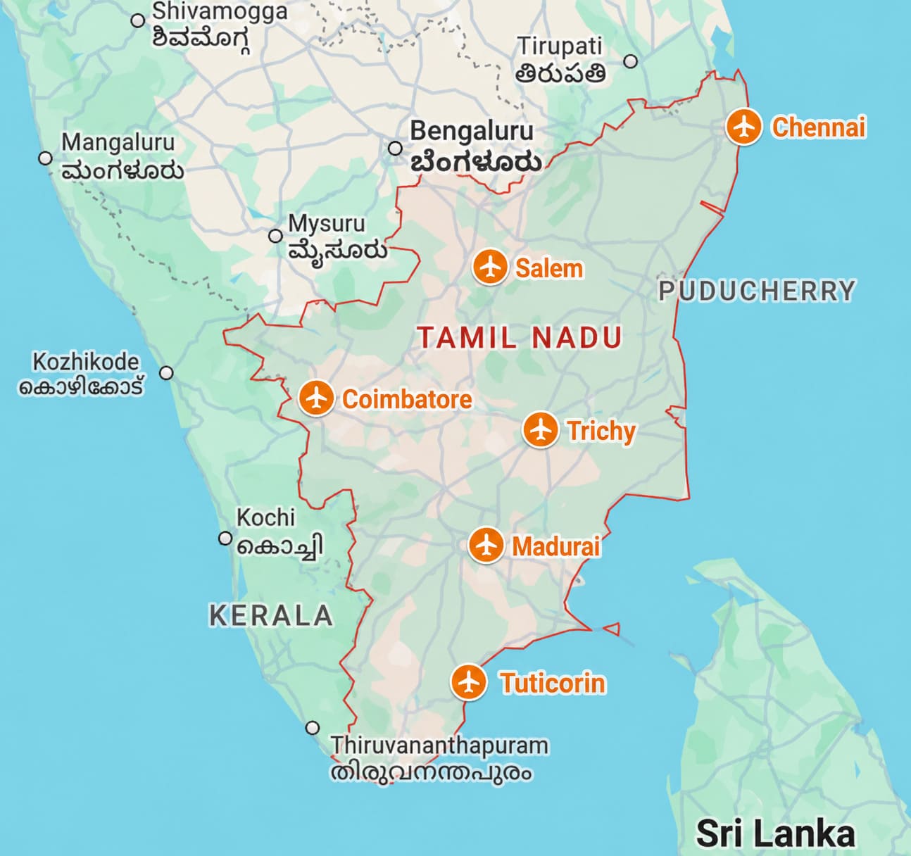
Tamil Nadu’s Dual Aviation & Defense Ceiling
Tamil Nadu represents one of India’s most complex real estate markets regarding airspace restrictions. The state contains four major operational international civil airports (Chennai, Coimbatore, Tiruchirappalli, Madurai), and strategic Indian Air Force (IAF) and Naval Air Stations (Tambaram, Sulur, Thanjavur, Arakkonam, Uchipuli).
Consequently, real estate projects across key urban corridors in Tamil Nadu face a dual regulatory layer: civil aviation clearances via AAI NOCAS and defense clearances under the Ministry of Defence (MoD) / Works of Defence Act.
Airport Color-Coded Zoning Maps (CCZM) and Airports Authority of India (AAI) height clearances regulate structural heights within a 20 km radius of airports to safeguard flight paths and radar systems.
By determining a site’s ground elevation relative to sea level (AMSL) and evaluating local obstacle limitation surfaces (OLS), developers can calculate maximum allowable building heights (AGL), submit NOC filings through the NOCAS portal, and prevent structural non-compliance before securing municipal building sanctions.
To know more about these regulations read about it in : https://community.verified.realestate/article/decoding-airport-cczm-aai-noc-height-restrictions/
Civil Airport Corridors in Tamil Nadu & Impacted Micro-Markets
A. Chennai International Airport (Tirusulam / MAA)
Chennai Airport operates dual intersecting runways (07/25 and 12/30), creating extensive overlapping approach funnels that stretch across major residential and commercial micro-markets.
- Severe Restrictive / Funnel Zones (Red & Inner Yellow): Tirusulam, Pallavaram, Meenambakkam, Chromepet, Pozhichalur, Pammal, and Anakaputhur. Building heights are severely capped (often 15m to 40m AGL). High-rise apartments are prohibited despite soaring land values along GST Road.
- Outer Horizontal & Conical Zones: Guindy, St. Thomas Mount, Velachery, Medavakkam, Tambaram West, Porur, and Poonamallee. Projects exceeding 10 to 12 floors must obtain NOCAS height verification.
B. Coimbatore International Airport (Peelamedu / CJB)
Coimbatore’s main growth vector along Avinashi Road intersects directly with the airport’s runway approach path.
- High Restrictive Zones: Peelamedu, Singanallur, Sitra, Kalapatti, and Hope College. Building heights are constrained along Avinashi Road, favoring IT parks and low-to-mid rise commercial complexes.
- Secondary / Conical Zones: Chinniampalayam, Neelambur, Saravanampatti, and Ondipudur. High-rise residential projects near Saravanampatti IT corridor require AAI elevation clearance.
C. Tiruchirappalli International Airport (Trichy / TRZ)
TRZ features a lengthened runway catering to international wide-body cargo and passenger jets, projecting an extended southern approach funnel.
- Direct Funnel Corridors: Kottapattu, K.K. Nagar, Gundur, Mathur, and Airport Township. Strict height caps restrict multi-story developments south of the city.
- Peripheral Zones: Pudukkottai Road corridor, Subramaniyapuram, and TVS Tollgate.
D. Madurai Airport (Perungudi / IXM)
- Impacted Micro-Markets: Perungudi, Avaniyapuram, Eliyarpathi, Thiruparankundram, and Mandala. Development along the Ring Road and Madurai–Virudhunagar highway must conform to CCZM grid limits.
E. Salem Airport (Kamalapuram / SXV)
Salem Airport is an active regional domestic hub managed by the Airports Authority of India (AAI). Operating under regional commercial and charter flight paths, its single runway creates a dedicated Obstacle Limitation Surface (OLS) across northern Salem.
- Direct Funnel & High-Restriction Zones: Kamalapuram, Omalur, Kottagoundampatti, and Sikkanampatty. Properties directly aligned with the runway approach ends face strict height caps to protect aircraft descent and climb paths.
- Secondary / Conical Zones: Salem–Omalur Expressway corridor, Jagirammapalayam, Karuppur, and Danishpet
Indian Air Force & Naval Air Stations: 1MoD Clearance Rules
Unlike civil airports where height is the primary restriction, military airbases enforce both airspace height limitations and ground security buffer zones under the Works of Defence Act. Construction within 100 to 500 meters of a military base perimeter requires explicit Ministry of Defence NOC.
| Military Airbase | Location / District | Key Impacted Regions | Special NOC & Restriction Rules |
| AFS Tambaram | Chennai Suburbs (Chengalpattu) | Selaiyur, East Tambaram, Camp Road, Madambakkam, Chitlapakkam, Vengaivasal, Padappai | Dual overlap with Chennai Civil Airport OLS & IAF pilot training circuits. Strict MoD clearance needed within 100m–500m perimeter wall. |
| AFS Sulur | Coimbatore East | Sulur, Kangayampalayam, Ravathur, Neelambur East, Karanampettai, Trichy Road corridor | Frontline fighter airbase (Su-30MKI, Tejas). Strict radar clearing and jet flight funnels; warehouse/logistics development dominates. |
| AFS Thanjavur | Thanjavur District | Pillayarpatti, Vallam, Pudukkottai Road (Thanjavur), Vilar, Sengipatti | Fighter base with high-speed low-altitude flight paths. Strict height caps on towers and industrial chimneys. |
| INS Rajali | Arakkonam (Ranipet) | Arakkonam Town, Kilvenkatapuram, Puliyamangalam | Longest military runway in Asia (P-8I Poseidon anti-submarine aircraft). Long approach funnel limits vertical builds. |
| INS Parundu | Uchipuli (Ramanathapuram) | Uchipuli, Mandapam, Ramanathapuram outskirts | Naval coastal surveillance strip; strict security clearance and coastal radar zone restrictions. |
Strategic Checklist for Developers & Buyers in Tamil Nadu
- CCZM Grid Verification: Before land acquisition in Chennai South, Peelamedu, or Tambaram, check the official AAI CCZM GIS map to determine the exact Permissible Top Elevation (AMSL).
- DGPS Survey: Conduct a Differential GPS survey to establish accurate ground elevation and WGS-84 coordinates.
- MoD Clearance Buffer Check: For land near AFS Tambaram or AFS Sulur, measure exact proximity to base perimeter walls to determine if a 100m–500m MoD security NOC is mandatory.
- Design Optimization: Plan low-density, wide-footprint developments (gated communities, logistics parks, sprawling commercial campuses) in tight funnel zones like Pallavaram, Pozhichalur, and Sulur where vertical building height is capped.
Note to Investors : The Airport NOC Finder by Verified.RealEstate is a Tamil Nadu property verification tool that maps over 2,700 airport NOC zones. By selecting a land parcel on its interactive map, users can instantly determine site elevation, maximum permissible building height (AGL), and specific AAI/DGCA or defense clearance requirements before constructing or purchasing property.
- Ministry of Defence ↩︎