

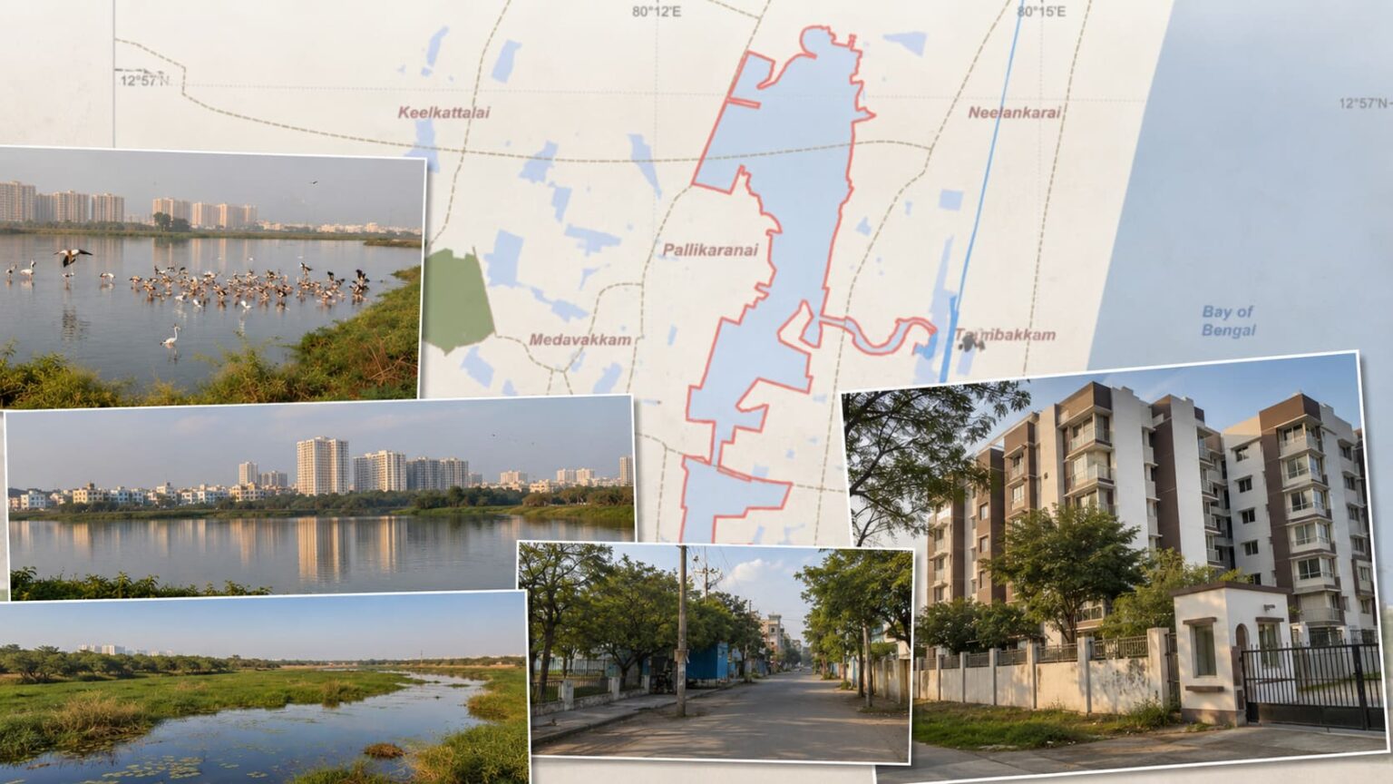
The intense legal battle over real estate development near Chennai’s crucial freshwater ecosystem has taken a pivotal turn. In a significant submission to the Madras High Court, the Tamil Nadu State Wetland Authority (TNSWA) clarified that the highly controversial 1-km “zone of influence” surrounding the Pallikaranai Marsh is not a fixed, permanent circular buffer.
While this announcement offers a massive ray of hope for real estate developers, infrastructure planners, and thousands of local property owners, the administrative freeze on building permissions remains tied to a rigorous scientific timeline.
The Core Conflict: Why Was Construction Frozen Around Pallikaranai?
The dispute traces back to October 2025, when the Chennai Metropolitan Development Authority (CMDA) issued a blanket halt on planning approvals. This freeze followed directives from the Southern Bench of the National Green Tribunal (NGT), which aimed to safeguard the fragile ecosystem of the Pallikaranai Marsh—internationally recognized as a protected Ramsar site since 2022.
The environmental restriction effectively locked out development across roughly 8,397 acres of prime urban land in South Chennai. However, the Confederation of Real Estate Developers’ Associations of India (CREDAI) quickly mounted a legal challenge in the Madras High Court. CREDAI argued that drawing a simple 1-km radius overlay onto a heavily urbanized economic hub was an arbitrary, unscientific approach that bypassed due statutory processes.
“No Fixed Buffer”: The Wetland Authority’s Breakthrough Clarification
Addressing the legal gridlock, the Tamil Nadu State Wetland Authority provided a crucial clarification on how environmental protection zones should actually be calculated under the Wetlands (Conservation and Management) Rules, 2017:
- Hydrology Over Geometry: The TNSWA confirmed that a uniform, 1-km circular ring cannot be used as a permanent boundary everywhere. Instead, the true regulatory zone must be dynamic—narrower in some densely developed spots and wider in others.
- Site-Specific Delineation: The final boundaries must be dictated entirely by detailed scientific studies, taking into account inlet and outlet channels, digital elevation models, regional topography, satellite wetlands, and natural drainage patterns.
- The Role of the Integrated Management Plan (IMP): The 1-km boundary mentioned in earlier documentation was merely an indicative marker from a draft plan. A finalized, upgraded Integrated Management Plan is currently being structured alongside the National Centre for Sustainable Coastal Management (NCSCM).
The Massive Human and Economic Toll of the Freeze
The Wetland Authority’s shift toward a data-driven, case-by-case approach comes as an immense relief to South Chennai’s economy. According to data presented by CREDAI Chennai during a recent press conference, the unscientific blanket freeze has triggered a widespread crisis:
- Over 1 Lakh Patta Holders Stranded: More than 1.20 lakh lawful land and property owners across highly populated hubs like Velachery, Perungudi, Sholinganallur, Thoraipakkam, and Perumbakkam have been trapped in financial limbo. Many are unable to secure bank loans, redevelop existing plots, or complete construction on half-built homes.
- Stalled Economic Activity: Business and real estate ventures valued between ₹51,700 crore and ₹71,500 crore have ground to a halt. Industry experts warn this could deal a crushing direct and indirect economic blow to state revenues, totaling nearly ₹19,790 crore.
- Public Infrastructure Blockades: The rigid 1-km buffer zone didn’t just impact private residential sectors; it also threatened crucial public infrastructure, including 15 upcoming stations along the Chennai Metro Rail (CMRL) Phase II corridor, two active MRTS railway stations, and a planned integrated transit hub at Sholinganallur.
What Happens Next? Can Construction Safely Restart?
Property owners and real estate developers cannot resume construction immediately. The Wetland Authority emphasized that the CMDA planning freeze remains active until a revised, official administrative order is passed.
The path forward relies entirely on the successful completion of the statutory process. The Revenue Department is actively managing the ground-truthing and survey-number verification to delineate the exact boundaries of the expanded 550-hectare Ramsar site. Once those coordinates are finalized and open to public stakeholder consultation, the NCSCM will scientifically map the official, non-circular zone of influence.
CREDAI and various local builders’ associations continue to urge the Tamil Nadu government to temporarily lift the planning freeze and process pending renewals and housing loans while this transitionary scientific mapping takes place.
Your writing is so relatable and down-to-earth It’s like having a conversation with a good friend Thank you for always being real with your readers
thank you