The Unsung Heroes of City Planning
Cities don’t just happen — they are measured into existence. Before a road is paved, a bridge is built, or a skyscraper rises, surveyors map the land with precision. They determine property boundaries, identify underground utilities, and provide the data that allows engineers, architects, and planners to shape safe, structured, and sustainable cities.
Without city surveyors, urban planning would be nothing more than guesswork.
What Do City Surveyors Actually Do?
Surveyors contribute to nearly every stage of development:
- Mapping property boundaries, roads, and lanes with accuracy
- Locating sewage lines, pipelines, and manholes
- Providing crucial data for roads, bridges, public spaces, and high-rises
- Supporting legal clarity in property ownership and boundary disputes
- Enabling smooth expansion of smart infrastructure and utilities
They don’t just measure land — they measure the future.
Who Conducts City Surveys?
National Authority
- Survey of India (SOI): Established in 1767, SOI is India’s oldest scientific organisation.
- Responsible for large-scale mapping, defence projects, and base data for city planning.
State & Local Authorities
- State Government Survey Departments: Appoint licensed surveyors for local municipal surveys.
- Responsible for property boundary accuracy, infrastructure layouts, and utilities.
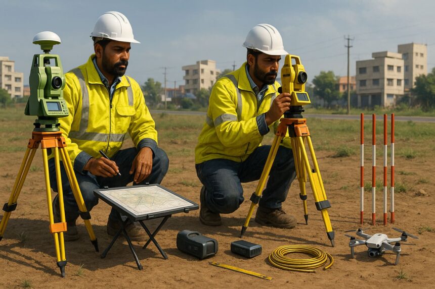
Tools and Technologies Used in City Surveys
Surveying today is a blend of traditional instruments and cutting-edge tech:
- GPS & Total Stations – pinpoint coordinates and elevations
- Theodolites – measure angles for plotting
- Plane Tables – map sketches directly on-site
- 3D Scanners & Drones – capture digital topography and underground data
- Ranging Rods & Invar Tapes – ensure straight lines and accurate distances
Types of Survey Maps Prepared
- Topographic Maps: Terrain, elevation, and land features
- Street Maps: Roads, lanes, and networks
- Property Maps: Boundaries and ownership details
- Underground Maps: Sewage lines, pipelines, and utilities
Beyond Mapping: Wider Roles of Surveyors
Surveyors aren’t just about land—they also:
- Ensure compliance with building regulations and safety codes
- Assess structural damage and suggest repairs
- Advise on energy efficiency and environmental impact
- Support insurance compliance and legal requirements
- Plan heritage conservation projects for historic buildings
Types of Surveyors in Action
Depending on the project, different specialists step in:
- Land Surveyors – property boundaries and legal land maps
- Construction Surveyors – roads, bridges, and skyscraper layouts
- Engineering Surveyors – support for major infrastructure projects
- Mining Surveyors – underground mineral mapping
- Hydrographic Surveyors – rivers, lakes, and seabed mapping
- Archaeological Surveyors – mapping historic/ancient sites
- Cartographic & Geodetic Surveyors – large-scale and global mapping
- Property Surveyors – evaluating building condition and repairs
- Aerial Surveyors – drones and aerial photography for mapping
- Topographic Surveyors – land contours and elevation studies
Why This Matters for Property Owners and Buyers
Whether you’re buying land, resolving a boundary dispute, or planning construction, accurate surveys protect you from legal headaches and financial risks. Platforms like Verified.RealEstate integrate survey insights into property verification .