

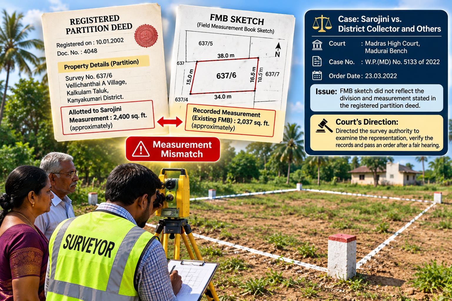
One of the most frustrating problems property owners in Tamil Nadu face is a mismatch between their registered property deeds and the government land map, known as the FMB (Field Measurement Book) sketch.
When boundaries or land dimensions on the government map do not match your registered sale or partition deed, it can create delays during property sales, building approvals, or boundary fencing. A key ruling by the Madurai Bench of the Madras High Court (Sarojini v. District Collector and Others) provides a clear legal solution for landowners.
The Problem: When Government Maps Fail to Match Your Deed
In this case, a property owner named Sarojini discovered a mistake in the official FMB map for her land (Survey No. 637/6 in Kanyakumari District).
- The Foundation: She owned the property through a legally registered Partition Deed from January 2002.
- The Discrepancy: The land measurements recorded on the government’s FMB sketch did not match the measurements stated in her registered deed.
- The Delay: She submitted a formal application in August 2021 asking officials to fix the map based on her registered deed. However, revenue and survey officers ignored her application for months without taking action.
Faced with official delay, she filed a legal petition in the Madras High Court to force the survey department to act.
The High Court Order: Deeds Take Priority in Map Corrections
Justice Abdul Quddhose ruled in favor of the property owner, laying down clear directives for land survey officials:
- Mandatory Deed Review: Survey authorities must review applications for FMB map corrections by comparing them directly against registered title deeds (such as sale deeds or partition deeds).
- Fair Hearing: Officials must conduct a proper inquiry and give a fair hearing to both the applicant and neighboring property owners.
- Strict 12-Week Deadline: The court ordered the authorities to complete the inquiry and pass a final written order within 12 weeks of receiving the court copy.
(Note: A court order compelling government officials to perform their mandatory duty is legally known as a Writ of Mandamus).
Step-by-Step Procedure to Rectify Your FMB Sketch
If you notice a measurement error on your FMB sketch, you do not need to go straight to court. Follow this structured process:
1. Verification & Application
- Gather Documents: Collect your registered original title deed (Sale Deed or Partition Deed), Patta, A-Register extract, and the existing flawed FMB sketch.
- Verify with Private Experts: Before approaching government revenue offices, consider hiring expert private surveyors to measure your boundary markers against your deed lines. You can utilize Verified.RealEstate’s Land Survey Services to get an accurate, independent field report to present alongside your application.
- Submit Written Request & Pay Fees: Visit your local Taluk Office to submit a written petition to the Taluk Surveyor or Head Surveyor. Pay the official government survey fee online via the e-Sevai / TamilNilam portal or Taluk treasury and secure your acknowledgment receipt.
2. Standard Official Timelines
Under standard Tamil Nadu Revenue Department rules and the Right to Services framework:
- Standard Survey: Officials are expected to conduct the survey and process the application within 30 working days of fee payment.
- Sub-division & Rectification: Complex cases requiring FMB corrections typically carry an administrative timeline of 30 to 60 days.
- Court-Ordered Mandates: If a High Court directive is secured, authorities are bound by a strict 12-week (84-day) deadline to complete the inquiry and issue final orders.
Escalation Procedure: What If the Surveyor Delays or Fails to Upload?
If the field surveyor fails to conduct the survey within the statutory 30-day period or neglects to upload the rectified FMB sketch into the online revenue portal, follow these escalation steps:
- Escalate to the Assistant Director of Land Survey (ADLS): Submit a formal written complaint to the District’s Assistant Director of Land Survey, who oversees all taluk surveyors, attaching your original fee receipt and application copy.
- Submit a Grievance at the District Collectorate: Attend the weekly Public Grievance Redressal Day (held every Monday at the District Collectorate) and present a petition directly to the District Revenue Officer (DRO) or District Collector.
- File an RTI Application: File a Right to Information (RTI) query seeking the exact status of your application, reasons for the delay, and the name of the officer holding the file.
- Lodge an Online Portal Complaint: Submit an official grievance via the CM Special Cell / IGRS portal to trigger time-bound oversight from higher state authorities.
- Legal Recourse via High Court: If administrative delays persist, file a Writ of Mandamus in the High Court using the Sarojini precedent to compel the survey department to finalize the measurement and upload the updated FMB map within a set judicial deadline.